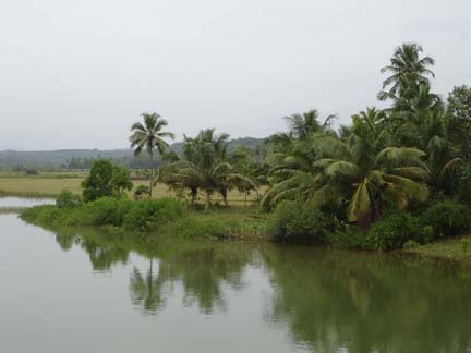
The usual word-suffixes for designating villages in Dravidian languages in southern India are -oor, palli/ halli, grama, naaD, koppal etc. However, the Karavali region has a large number of somewhat unusual village name suffixes that evidently represent specific trends in evolution of words some of which are common to all the south Indian languages. The Karavali during the various early historical periods being a settlement of assorted tribes with their own languages, we can expect input of primitive words from their languages that have formed the base from which the present set of words were evolved. Note some of the delicate implication of evolutionary trends in the following place indicators.
Ar.> Avara
It has been suggested that the Indo-European root word 'Ar' as in Aryan represents agriculture or cultivation. However similar root is found in Dravidian languages. For example 'ārankei' represented the open palm of the hand, for example, in Kolami (Dravidian)language. The word 'ārankei' later became 'angai '(palm of hand) in various Dravidian languages. Thus we can deduce that original root 'ār' or 'āran' meant open area or field.
The natural open fields that facilitated as the human settlements during the early civilization were possibly designated with the suffix -ar. There are a large number of villages/hamlets in Karavali that have the suffix -ar. For example: Todar, Bolar, Kemar, Mijar, Mudar, Madar, Palar, Pilar,Ubar etc. And Arantodu, Arambodi Arabail etc.
With passage of time the ār was converted to -āra or -āru. (Bantara, Bolāra, Kantāra, Kemaru, Mijaru etc).
New words were created later in time span by adding short modifying prefixes. For example: mār (m+ār) meant agricultural field, probably slightly elevated than ār.(For example: Malemar, Bakimar, Palimar, Palemar, Barimar etc) Similarly kār( k+ ār) represented wooded field(Ajekar, . And jār (j+ ār) for sloping ground. The -gār and -chār became variants of -kār and -jār. For example Alangar, Kannangar, Mangar, Kodichar, Kolchar etc.
Further innovation, especially Sanskritization modified and refined the ār hamlets into -avara. (Attavara, Udyavara, Banavara, Mangalavara Neelavara, Pejavara etc).
r.> L With passage of time, probably during Vijayanagar and later period, with conversion of r.> L, the 'mār' beacame 'māLa'. Names like MāLa, GomāLa, ErumāLa etc came into being.
aDi.> adka
The suffix 'aDi' possibly originally referred to cool shade of a tree, that was later extended to mean huts,hamlet or habitation etc. Nelyādi, Kalyādi, Manjanādi, Nekkilādi, Amtādi, etc An variant of -aDi was -aDa. For example Kokkada.
The PāDi (pa+aDi;= farm) developed from -aDi. Examples: Kukkipādi, Bellipādi, Baikampādi etc. In some areas -pāDi has become -bāDi. For example: Kannambādi, Kodimbādi,etc..
The suffix 'aDka', evolved from -aDi, and means open ground or yard. Possibly, it developed later as a regional variant of the suffix-ar. Examples include Kudthadka, Aladka,Pāladka, Kalladka, Mulladka, etc.
Al
The suffix -al or its later forms -ala , -alu or āL meant water course, river or stream. It was employed to represent land area or field by the side of a stream. Bajāl, Kaipunjāl, Kudala, Koppalu, Alupe, Alike, Aluve, Pāngala etc. The -sāl (s+āl), -jāl (j+āl) , -vāl (v+āl) and -chāl (ch+āl) became the modified variants of -āl. For example: Nadisāl, Kodijāl, Heranjāl, Ilavāla etc.
aN
The āN is an another basic suffix (with its later variants -aNNu, or -aNe) that represented soil, land or field. For example: Belman, Muddān, Kemman, Kondāna, Kodmān, Kokkarne, Perne, Marne etc.
Also the words KonkaNa, PaDuvaNa(=western), MooDaNa (=eastern), tenkaNa (=southern )etc.were formed in this fashion. So, the word 'konkaNa' refers to notched/crooked coastline between Goa and Gokarna: konk(crooked, hook-like,non-linear)+aNa (land).
Naturally, the common word maNNu (=soil) is a compound of m+aNNu. (Similar analysis can be extended for the word 'haNNu' (=fruit), the agricultural product.
Anj.> Aje
The -anj or -anje (along with its regional variant -ang) was one of the ancient basic word that possibly suggested developed area, shops or township. Possibly the root word '-anj' originally meant 'a sloping ground ' or 'hill-slope' as we find that in the Kolami-Gadaba languages the word 'anj' means climb.
Several zone indicators were evolved from the basic word - anj , such as:
banja. (=barren/dry)
kanja (=reddish )
kunja, (=hilly)
manja (=even land)
nanja, (=farmland)
punja, (=rocky)
renja ...(=fragrant/delightful)....etc.
Many of these words were compounded with -ar into Kunjar, Manjar (>Manjarur), Kenjar, Banjar etc.
The words angar( Naiki language), angari (Naikri language ) and angad (Parji language) mean courtyard or bazaar in ancient Dravidian languages.Thus the word 'Mangar' (m+ang+ar=Ancient Mangalore) could be an earlier variant of the word 'Manjar' (m+anj+ar) or Manjarur. The word 'angar' was an ancient equivalent of 'angadi', the bazaar. The words 'angār' and 'angaDi' (=bazaar) (as in Haleanagdi, Uppinangadi, Belthangadi, Hosanagadi Koppalangadi, Murathangadi, Mudarangadi etc) were in turn derived from --anj or -ang.
Some of these words were modified in later period. For example 'manja' (as in Ballamanja, Kalmanja) became 'maja' as in '-majalu.'(as in Kanakamajalu).
Similarly 'kanje' became 'kaje', banje .> 'baje' with passage of time.
Land classification words like nanja, punja etc are used even today in Kannada also. Examples for village names embodying -anj derivatives include: Markanja, Balkunje, Elinje, Heggunje, Kudkunja, Kedinje, Innanje, Bannanje, Surinje, Kunjathabail, Punjālkatte, The 'nanja' became 'nancha' (as in Nanchar) in some areas.
Ank, ang
The -anj had two variants namely : -ang and -ank. The -ang/e and -ank/i variant of -anj/e can be examplified by Varanga,Kodange, Parenki, Neranki, Pernakila etc. The-ank (=yard, small piece of land; e.g. Koli-anka) evolved into place names such as Manki (m+anki), Permanki etc. Even the word Lanka (island) can be considered as ( l+anka or the land within water; la- being shortened form of al/a=water). The 'ank' later evolved to represent the 'number'
The 'anj' root word with passage of time became '-aj 'or '-aje'. Variants of 'aje' include Aje(<.anje), Kaje(<.kanje), maje/majalu (<.manje) and Baje(<.banje). Village names such as Ajekār, Baje, Bajāl, Bajape Kaje, Kajekār, Konaje, Pāthaje, Derāje, etc abound in the Karavali.
Oli
The suffix word -Oli or -OLi could be of Prakrit origin as it has been traced to Marati areas as a village indicator. For example of -Oli are: Innoli, Maroli, Kudroli, etc.
One of the possibility is that the suffix '-goLi' in many of the village names (like Bajagoli, Kinnigoli, Goliangadi, Taudugoli, Asaigoli etc) could actually be a derivative of Oli (g+oli) rather than the goLi, the banyan tree, as commonly presumed so far!
Odi
The suffix Odi apparently has several meanings as enlisted in the Tulu nighantu. However, it could be geographical indicator of 'bettu' (upland) is suggested by the Kannada equivalent name 'Hosabettu' of the original Tulu place name 'Posodi'. Examples of Odi villages include Odipu, Posodi, Arambodi,
The Odi could be a regional variant of Oli as we find analogy between Oli>goLi and Odi >k+ODi, ODu>> k/g+oDu.
Further variants of -Odi are -kODi (Kodi. Aluvekodi, etc). And for -Odu and -koDu or -goDu or -toDu., we find examples in Kumragodu, Balgodu, Kasarkodu, Kasargodu, Arantodu etc.
Oor
The origin of the word oor can be traced to the name of the renowned ancient Sumerian city, Ur , that dated back to some 6000 BCE. The names of ancient Indian historical cities Mathura (Uttar Pradesh)and Madhuarai (Tamilnad) were based on the root word -ur or -oor.
Now the suffix -oor is the most common indicator (Mangalur, Bengalur, Maisur,alur, Belur, Begur, Puttur, Tumkur, Kittur, Nellur, Chittur, etc) of village/town/city names in southern India.
An old form of -oor was -uri. Place names like Naguri, Hebburi (Hebri), Uruval, etc. were based on these. The -uri form apparently was used by ancient Munda tribes as one of their language was called Naguri.
Pu.>pura
There are a number of ancient village names that end with -pu or- pe. For example:Alape, Didupe, Bajape, Belapu, Mudipu, Kudupu etc. The -pe suffix was altered to -be in some areas. (Example Perabe). The original -pe or -pu possibly represented township. Later on the -pu suffix was merged with -ur that probably led to the formation of Sanskrit suffix 'pura' (p'+ ura) as in for example Kundapura, Kalyanpura, Manipura, Sakleshpura; Kanpur, Nagpur, Jaipur etc.
Se
The suffix -se has become a place indicator in several village names such as Avarse, Vaddarse, Teggarse etc. The -se suffix could possibly be a regional variant of -pe.
Readers may offer their opinions or disagreements if any on the above topic.
®
Ar.> Avara
It has been suggested that the Indo-European root word 'Ar' as in Aryan represents agriculture or cultivation. However similar root is found in Dravidian languages. For example 'ārankei' represented the open palm of the hand, for example, in Kolami (Dravidian)language. The word 'ārankei' later became 'angai '(palm of hand) in various Dravidian languages. Thus we can deduce that original root 'ār' or 'āran' meant open area or field.
The natural open fields that facilitated as the human settlements during the early civilization were possibly designated with the suffix -ar. There are a large number of villages/hamlets in Karavali that have the suffix -ar. For example: Todar, Bolar, Kemar, Mijar, Mudar, Madar, Palar, Pilar,Ubar etc. And Arantodu, Arambodi Arabail etc.
With passage of time the ār was converted to -āra or -āru. (Bantara, Bolāra, Kantāra, Kemaru, Mijaru etc).
New words were created later in time span by adding short modifying prefixes. For example: mār (m+ār) meant agricultural field, probably slightly elevated than ār.(For example: Malemar, Bakimar, Palimar, Palemar, Barimar etc) Similarly kār( k+ ār) represented wooded field(Ajekar, . And jār (j+ ār) for sloping ground. The -gār and -chār became variants of -kār and -jār. For example Alangar, Kannangar, Mangar, Kodichar, Kolchar etc.
Further innovation, especially Sanskritization modified and refined the ār hamlets into -avara. (Attavara, Udyavara, Banavara, Mangalavara Neelavara, Pejavara etc).
r.> L With passage of time, probably during Vijayanagar and later period, with conversion of r.> L, the 'mār' beacame 'māLa'. Names like MāLa, GomāLa, ErumāLa etc came into being.
aDi.> adka
The suffix 'aDi' possibly originally referred to cool shade of a tree, that was later extended to mean huts,hamlet or habitation etc. Nelyādi, Kalyādi, Manjanādi, Nekkilādi, Amtādi, etc An variant of -aDi was -aDa. For example Kokkada.
The PāDi (pa+aDi;= farm) developed from -aDi. Examples: Kukkipādi, Bellipādi, Baikampādi etc. In some areas -pāDi has become -bāDi. For example: Kannambādi, Kodimbādi,etc..
The suffix 'aDka', evolved from -aDi, and means open ground or yard. Possibly, it developed later as a regional variant of the suffix-ar. Examples include Kudthadka, Aladka,Pāladka, Kalladka, Mulladka, etc.
Al
The suffix -al or its later forms -ala , -alu or āL meant water course, river or stream. It was employed to represent land area or field by the side of a stream. Bajāl, Kaipunjāl, Kudala, Koppalu, Alupe, Alike, Aluve, Pāngala etc. The -sāl (s+āl), -jāl (j+āl) , -vāl (v+āl) and -chāl (ch+āl) became the modified variants of -āl. For example: Nadisāl, Kodijāl, Heranjāl, Ilavāla etc.
aN
The āN is an another basic suffix (with its later variants -aNNu, or -aNe) that represented soil, land or field. For example: Belman, Muddān, Kemman, Kondāna, Kodmān, Kokkarne, Perne, Marne etc.
Also the words KonkaNa, PaDuvaNa(=western), MooDaNa (=eastern), tenkaNa (=southern )etc.were formed in this fashion. So, the word 'konkaNa' refers to notched/crooked coastline between Goa and Gokarna: konk(crooked, hook-like,non-linear)+aNa (land).
Naturally, the common word maNNu (=soil) is a compound of m+aNNu. (Similar analysis can be extended for the word 'haNNu' (=fruit), the agricultural product.
Anj.> Aje
The -anj or -anje (along with its regional variant -ang) was one of the ancient basic word that possibly suggested developed area, shops or township. Possibly the root word '-anj' originally meant 'a sloping ground ' or 'hill-slope' as we find that in the Kolami-Gadaba languages the word 'anj' means climb.
Several zone indicators were evolved from the basic word - anj , such as:
banja. (=barren/dry)
kanja (=reddish )
kunja, (=hilly)
manja (=even land)
nanja, (=farmland)
punja, (=rocky)
renja ...(=fragrant/delightful)....etc.
Many of these words were compounded with -ar into Kunjar, Manjar (>Manjarur), Kenjar, Banjar etc.
The words angar( Naiki language), angari (Naikri language ) and angad (Parji language) mean courtyard or bazaar in ancient Dravidian languages.Thus the word 'Mangar' (m+ang+ar=Ancient Mangalore) could be an earlier variant of the word 'Manjar' (m+anj+ar) or Manjarur. The word 'angar' was an ancient equivalent of 'angadi', the bazaar. The words 'angār' and 'angaDi' (=bazaar) (as in Haleanagdi, Uppinangadi, Belthangadi, Hosanagadi Koppalangadi, Murathangadi, Mudarangadi etc) were in turn derived from --anj or -ang.
Some of these words were modified in later period. For example 'manja' (as in Ballamanja, Kalmanja) became 'maja' as in '-majalu.'(as in Kanakamajalu).
Similarly 'kanje' became 'kaje', banje .> 'baje' with passage of time.
Land classification words like nanja, punja etc are used even today in Kannada also. Examples for village names embodying -anj derivatives include: Markanja, Balkunje, Elinje, Heggunje, Kudkunja, Kedinje, Innanje, Bannanje, Surinje, Kunjathabail, Punjālkatte, The 'nanja' became 'nancha' (as in Nanchar) in some areas.
Ank, ang
The -anj had two variants namely : -ang and -ank. The -ang/e and -ank/i variant of -anj/e can be examplified by Varanga,Kodange, Parenki, Neranki, Pernakila etc. The-ank (=yard, small piece of land; e.g. Koli-anka) evolved into place names such as Manki (m+anki), Permanki etc. Even the word Lanka (island) can be considered as ( l+anka or the land within water; la- being shortened form of al/a=water). The 'ank' later evolved to represent the 'number'
The 'anj' root word with passage of time became '-aj 'or '-aje'. Variants of 'aje' include Aje(<.anje), Kaje(<.kanje), maje/majalu (<.manje) and Baje(<.banje). Village names such as Ajekār, Baje, Bajāl, Bajape Kaje, Kajekār, Konaje, Pāthaje, Derāje, etc abound in the Karavali.
Oli
The suffix word -Oli or -OLi could be of Prakrit origin as it has been traced to Marati areas as a village indicator. For example of -Oli are: Innoli, Maroli, Kudroli, etc.
One of the possibility is that the suffix '-goLi' in many of the village names (like Bajagoli, Kinnigoli, Goliangadi, Taudugoli, Asaigoli etc) could actually be a derivative of Oli (g+oli) rather than the goLi, the banyan tree, as commonly presumed so far!
Odi
The suffix Odi apparently has several meanings as enlisted in the Tulu nighantu. However, it could be geographical indicator of 'bettu' (upland) is suggested by the Kannada equivalent name 'Hosabettu' of the original Tulu place name 'Posodi'. Examples of Odi villages include Odipu, Posodi, Arambodi,
The Odi could be a regional variant of Oli as we find analogy between Oli>goLi and Odi >k+ODi, ODu>> k/g+oDu.
Further variants of -Odi are -kODi (Kodi. Aluvekodi, etc). And for -Odu and -koDu or -goDu or -toDu., we find examples in Kumragodu, Balgodu, Kasarkodu, Kasargodu, Arantodu etc.
Oor
The origin of the word oor can be traced to the name of the renowned ancient Sumerian city, Ur , that dated back to some 6000 BCE. The names of ancient Indian historical cities Mathura (Uttar Pradesh)and Madhuarai (Tamilnad) were based on the root word -ur or -oor.
Now the suffix -oor is the most common indicator (Mangalur, Bengalur, Maisur,alur, Belur, Begur, Puttur, Tumkur, Kittur, Nellur, Chittur, etc) of village/town/city names in southern India.
An old form of -oor was -uri. Place names like Naguri, Hebburi (Hebri), Uruval, etc. were based on these. The -uri form apparently was used by ancient Munda tribes as one of their language was called Naguri.
Pu.>pura
There are a number of ancient village names that end with -pu or- pe. For example:Alape, Didupe, Bajape, Belapu, Mudipu, Kudupu etc. The -pe suffix was altered to -be in some areas. (Example Perabe). The original -pe or -pu possibly represented township. Later on the -pu suffix was merged with -ur that probably led to the formation of Sanskrit suffix 'pura' (p'+ ura) as in for example Kundapura, Kalyanpura, Manipura, Sakleshpura; Kanpur, Nagpur, Jaipur etc.
Se
The suffix -se has become a place indicator in several village names such as Avarse, Vaddarse, Teggarse etc. The -se suffix could possibly be a regional variant of -pe.
Readers may offer their opinions or disagreements if any on the above topic.
®