Showing posts with label Sasihitlu. Show all posts

Tuesday, August 19, 2008

137.Chitrapu


Chitrapu is a picturesque peninsula like semi-island along the Karavali coastline located southwest of Mulki town. It is formed in the coastal stretch where the Rivers Shambavi (Mulki) and Nandini (Pavanje) join together before disgorging into the Arabian Sea.The area west and southwest of Chitrapu, including Sasihitlu and Mukka is infamous for severe sea erosions especially during the peak monsoons.

Shekar Chitrapu
Shekar Chitrapu has compiled informative and useful geological and historical data available on Chitrapu in his Kannada essay ‘Chitrapu gramada Charitre: Ondu adhyayana haagoo upalabda maahitigalu’ (History of Chitrapu village: A Study and Available data) published in a regional souvenir.

River mouth drift
Shekar Chitrapu has documented the drift or migration of the combined river mouth of the Rivers Nandini and Shambavi at the sea front near Chitrapu during the recent history.This fact is also established by comparision of Survey of India toposheets documented for the years 1916 and 1968 and later satellite imageries of the area.
The northward migration of the river mouth is due to upliftment of the crust especially around Mangalore.An eastwesterly ridge traversing peninsular India along Mulki/Mangalore in the West Coast and Pulicat in the East Coast has been documented by geological studies.The rise of the ridge has been slow and steady over the years leading to gradual or abrupt migration of river mouths and other relevant Geomorphological features.

Bappanadu
However, available data and evidences suggest that the Rivers Shambavi and Nandini were independently joining Arabian Sea before 19th century. The data is in conformity with the palo-geography of Gurupur- Netravathi duo.River Gurupur was joining the Sea independently of River Nethravathi until Nineteenth Century CE and one fine monsoon day in the year 1887 River Gurpur abruptly took a southerly turn and joined River Nethravathi before emptying into the Sea.
The story must have been similar in the case of Shamabavi and Nandini Rivers even though the year of joining of these two rivers has not been documented so farThe status of River Shambavi joining directly into Arabian Sea (independently of River Nandini) is supported by the fact that the present Bappanadu was a port where ships in the olden days used to dock.
The merchant ship of Bappa Beary was mysteriously stranded in the estuary here, according to local legends, and it was cleared after he offered to build a temple in honour of Durga Paramesvari.The temple is known as Bappanad Durga Paramesvari temple and it was rebuilt in the present site during later years.

Chitrapu Niyogis
A class of Telugu Brahmins of Andhra Pradesh is known as Niyogis. Niyogis are well known for for accomplishing intelligent executive works. Niyogi means appointed person or staff. One of the hundred and odd surnames of Telugu Niyogi Brahmins of Machilapatam, Andhra Pradesh, is ‘Chitrapu’. ‘Aruvel Niyogis’ (=six thousand appointed staff) were said to have been deployed during Vijayanagara reign for supporting administrative works of the warriors (Kshatriyas). Possibly, these six thousand recruitees were drawn from different parts of southern India including the Karavali.
Thus the Chitrapu Niyogis were possibly originally drawn from the Chitrapu near Mulki during 13-14 century CE.The connection of Niyogis to Karavali-Kerala is further supported by the fact that the Niyogi surnames also include ‘Uppala’ and ‘Malyala’.

Chitravahana
The place name Chitrapu (Chitra+apu, the ’Chitra’ village) apparently is derived from the name of Alupa King Chitravahana I (680 -730 CE) who ruled Karavali and parts of Sahaydri like Edivolal (present Banavasi) areas during early Eigth Century CE. Chitravahana I was a powerful King among Alupas. He married queen Kumkuma Devi of Chalukya dynasty which was ruling at ruling at Badami.
There is one more King Chitravahana II documented in Alupa history (760-800 CE). However, the name Chitrapu may have been associated with the famous Chitravahana I who was ruling in the Mangalapura and Banavasi regions.

Alupa
Alupa family has been considered to have originated at ‘Alupe’ village in eastern part of presnt Mangalore city.Then it needs to be explored why this village chitrapu was named after the King Chitravahana

Chitrapu
One possible reason is that Chitrapu area was a flourishing port and urban area developed by Chitravahana I during 7th and 8th Centuries CE.Other reason could be that Chitravahana I or his mother hailed from this area, which was later renamed after the popular King of the time.

Chitrapura
There are atleast two more villages in the Karavali named ‘Chitrapura’: one near Baikampadi (Mangalore) and another in the proximity of Shirali (Uttara Kannada). Compared to the antique name of Chitrapu, the new name ‘Chitrapura’ implies a subsequent date in the history. It is not clear whether these villages were named after Alupa King Chitravahana II (760-800 CE).

Readers with additional data on the area may add their comments
®

Sunday, April 20, 2008

110. Mukka


Bhagavathi temple at Kadike,northern beach of Mukka-Sasihitlu.

Travelling northward from Mangalore to Udupi, after Surathkal you shall find places called Mukka and Sasihitlu, where Pavanje and Mulki rivers confluence before debouching into Arabian Sea. A northern part of this coastal beach area is called 'Sasihitlu' or 'Kadike'. ‘Sasihitlu’ can be translated as a compound consisting of seedlings and the ‘Kadike’ refers to short native grass or the ‘garike’.
The part of Mukka beach is known as Mitrapatna,possibly signifying influence of Buddhism .However,it is said that the name Mitrapatna is a recent one,ca. 1920 (Hosabettu Viswanath). Near Kadike in the northern part of Mukka,is a Bhagavathi temple evincing eroded marks of transition from Buddhism to Hinduism.Some more studies may be requirred to prove or disprove the Buddhist heritage of Mukka, apart from the Bhagavathi temple.
A part of the beach area between Mukka and Sasihitlu is designated Lacchil meaning a garden with cultivated plants.Note the analogies between the words Sasihitlu and Lacchil.

Mukka
Mukka appears to be an unusual place name. The word Mukka means deformed. It also means ‘blow with the fist’ signifying destructive attack. Of the several words derived from the Mukka, the interesting one is ‘mooka’ (=dumb).
Sea erosion
Well, to explain why the place acquired such a negative or ominous name, we have to take the help of coastal geomorphology and geography of the area. The Mukka beach is known for severe sea erosions during the monsoon period. Severe sea erosions involve destructive attack of powerful storm surged sea waves that destroy the delicate sandy beaches. The coastal wave attack destroys, in successive stages, everything that is near the beach such as plants, buildings and structures.
It seems the beach was destroyed many times in the historical past due to severe sea erosions which prompted our ancestors to name the place as Mukka!
This again proves that our ancestors were highly conscious of the geography of the places they lived in.

Mukha.>Mukka
There is one more interesting legendary angle to the derivation of the place name Mukka.
A divine connection is cited by Mithrapatna Narayan A. Bangera in his book 'Kandevu Kshetra Mahatme'. As against the several reincarnations of Lord Vishnu, Lord Shiva has a few ones. He established 'Tulasi vrindavana' in every home by destroying Tripura. He bestowed longevity to Maarkhandeya, son of Muni Mrikhandu. He became the main deity of Dravida Race by appearing before Hunter Kannappa, who offered his own eyes in devotion. In the guise of a hunter, he bestowed Pashupataasra to Arjuna. He appeared as 'Dharmarasu Ullaya (meaning 'Swayambhu)' in River Nandini in the form of a face. The west of River Nandini where he put his face is called mukha(=face)>Muga>Mukka. The place where he 'espied to stay' is now called as Kandya/Kandevu (also Khandige). Thus these western and eastern sides of Nandini are considered as sacred places.The Yermal Festival is harbinger of festivals of Tulu Nadu and Kandevu festival signifies end of festivals in a year. Hence the famous saying: "Yermal jappu Kandevu Adepu".

Acknowledgments: Hosabettu Viswanath
®

Monday, March 24, 2008

104. Formation of Barrier Spits

A barrier Spit is a coastal sandy strip of land bound by the Sea on one side and river on the other. The Bengare to Tannirbavi coastal strip west of Mangalore is a Barrier Spit. As explained in a previous post in this blog, the Bengare- Tannirbavi Barrier Spit was formed by the migration of Gurupur River in the year 1887.
However, this not the only Barrier Spit formed in the recent past history. Oral tradition preserved with the elderly people of Karavali, suggest that several Barrier Spits along the Karavali were formed in the recent past centuries, even though the exact dates are not remembered.

Mulki –Sasihitlu Spit
The Bappanad temple, Mulki, has been shifted and re-built at the present location about a couple of centuries ago. The elderly people at Mulki report that the Bappanad temple was located on the banks of Mulki River near the old port of Mulki, about half a kilometer east of the present position of the temple. At that time the merchant ships have had direct entrance to the Mulki River from the Sea.
The data suggests that the mouth of Mulki river has been shifted southwards during the recent past centuries like River Gurupur.

Hoode –Bengare Spit
Similar anecdotes are available for the Hoode-Bengare Spit in Udupi taluk where Swarna and Sita Rivers join the Sea. Oral reports from the elderly people to their young ones explain how the rivers changed their course of flow during a story monsoon.

Kapu-Udyavara Spit
One more barrier Spit exists along the Kapu-Kaipunjal–Polipu-Udyavara coast. The Udyavara River takes a northward bend parallel to the coastline forming a thin Barrier Spit that ends near Malpe. This also could have happened during the recent past like the other Spits cited above.

Time of Spit formation
Documentation of date/year of these Spit formation is important for historical as well as geo-morphological studies. It appears that this type of information is available only obscurely in oral tradition, where grandfathers/grandmothers describe the wonder of the nature to their kids.
Or it is possible that some people with sharp sense of history and documentation may have recorded the date/year and nature of such changes. Anybody having any authentic relevant information on these natural changes may kindly pass on the information to this blogger for the benefit of the society in general.
®

Blog Archive

Books for Reference

  • A Comparative Study of Tulu Dialects By Dr. Padmanabha Kekunnaya. Govinda Pai Reserach Centre, UDupi. 1994
  • Koti Chennaya: Janapadiya Adhyayana. By Dr. Vamana Nandavar. Hemanshu Prakashana ,Mangalore.2001.
  • Male kudiyaru. Dr B. A.Viveka Rai and D.Yadupathi Gowda, Mangalore University,1996.
  • Mogaveera Samskriti By Venkataraja Punimchattaya. Karnataka Sahitya Academy.1993.
  • Mugeraru:Jananga Janapada Adhyayana. By Dr Abhaya Kumar Kaukradi.Kannada & Culture Directorate,Bangalore & Karnataka Tulu Academy, Mangalore,1997.
  • Puttubalakeya Pad-danagalu. Ed: Dr B.A.Viveka Rai,Yadupati Gowda and Rajashri, Sri Dharmasthala Manjunatheswara Tulu Peeta. Mangalore University.2004
  • Se'erige. Ed:Dr K.Chinnapa Gowda.Madipu Prakashana,Mangalagangotri,2000.
  • Studies in Tuluva History and Culture.by Dr P Gururaja Bhat (1975).Milagres College,Kallinapur,Udupi.
  • Taulava Sanskriti by Dr.B.A.Viveka Rai, Sahyadri Prakashana,Mysore 1977
  • TuLu naaDu-nuDi By Dr.PalthaDi Ramakrishna Achar, Puttur.
  • TuLu NighanTu. (Editor in Chief: Dr U.P.Upadhyaya, Govinda Pai Research Centre,Udupi. Six volumes. 1988 to 1997
  • Tulu Patero-A Philology & Grammar of Tulu Language by Budhananda Shivalli.2004.Mandira Prakashana Mangalore. p.317. (The book is in Tulu Language using Kannada script)
  • TuLunadina ShasanagaLa Sanskritika Adhyayana. By Shaila T. Verma (2002) Jnanodaya Prakashana,Bangalore, p.304.(Kannada)
  • Tuluvala Baliyendre. Compiled by N.A.Sheenappa Hegde,Polali,Sri Devi Prakashana,Parkala,1929/1999

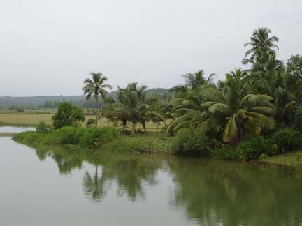
A Coastal estuary

A Coastal estuary
Holegadde near Honavar,Uttara Kannada dist, Karnataka

Copy? Right - but kindly remember to acknowledge!

Creative Commons License
This work is licensed under a Creative Commons Attribution 3.0 License.

" tulu-research.blogspot." ತುಳು ರಿಸರ್ಚ್. ಬ್ಲಾಗ್‌ಸ್ಪಾಟ್‌. ಇನ್

" tulu-research.blogspot."  ತುಳು  ರಿಸರ್ಚ್.  ಬ್ಲಾಗ್‌ಸ್ಪಾಟ್‌. ಇನ್
Have a nice day !