Mulki
is an unassuming small coastal town located midway on the National Highway 66 (formerly
NH17) that connects the port city of Mangalore with the temple town of Udupi
along the West Coast. It is located on the southern bank of the West flowing River
Shāmbavi.
The name for the town of Mulki was said to have been given by the Kanakadasa (ca.1508-1606
CE), a renowned proponent of Bhakti cult in Karnataka. Kanakadasa introduced
the place name Mulki in the 16th Century CE for a place earlier
known as Volalanke. Mulki was ruled by Samantha chieftains, whose inheritors
still remain in the present day as landlords in the area.
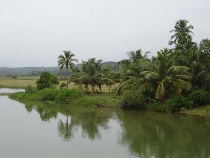
 |
| The Shambavi and Pavanje Rivers and theVillages around Mulki Town. |
Somewhere
in the period of 7th or8th Century CE, a Muslim merchant from the Beary
community, faced an acute problem as his merchant boat laden with rich goods was
struck at the Port of Volalanke. Someone from the locality advised him to pray
to Goddess of the area Bhagavathi/Durga and build a temple in her honour.
Merchant Bappa prayed to the Goddess and that he would build a temple in her honour if his boat was salvaged from the rough weather.
The
edicts of King Ashoka, ca 3rd Century BC, refer to Satiyaputo
which can be correlated with legendary Satyanapura
documented in the Siri PaDdana. The Eastern part of Mulki is the fabled domain
of legendary lady Siri comprising the
present villages of Mundkur, Bola, Kadandale and Kallamundkur. Further,the
legend of Parashuram essentially envisages a major event of retreat of the Sea
and emergence of land in the west Coast of India (known generally as
‘regression of the sea’ in geological parlance). Combining these anecdotes we
may infer that Siri legend predates the legend of Parashurama.
Recent
geological studies coupled with analysis of the available scanty historical
data by this Tulu research team reveal that Mulki is part of the coastal strip
of land that emerged from the Arabian Sea approximately during the beginning of
the Common Era. However, the natural process of emergence of land from the Sea has
been metaphorically attributed in the prevalent coastal legends of the West
Coast of India to the miraculous feat accomplished by mythical Lord
Parashurama. Similarly the flow path or position of River Shambavi has altered
and indications suggest that the river has migrated laterally towards North in
the recent history of the Coast. We shall discuss some of these interesting
historical aspects in the light of our recent studies in this post.
Volalanke- Mulki
Writer
Narayana A. Bangera in his Kannada serial Hari
bhakti sāra being published in Mogaveera periodical of Mumbai, states
that Kanakadasa who visited this coastal area while he was travelling around
the temple town of Udupi, sometime in the 16th Century CE, renamed
the place originally known as Volalanke
as Mulki. The name Mulki has been Sanskritised in some references as Mulikapura.
The term Mulki possibly refers either to (1) the herb (moolike) or to (2) the land (derived from Urdu word Mulk).
The term Mulki possibly refers either to (1) the herb (moolike) or to (2) the land (derived from Urdu word Mulk).
The
Volalanke (or simply Olalanke) still remains as the name of a hamlet within
Mulki located about 2.5 km East of the Coastline. The area near the
Venkataramana Temple in the Eastern part of Mulki is still known as Volalanke.
The term Vola-lanke means an inner island or in other words an island within a
river. The coastal rivers of Karavali invariably consist of numerous small
islands generally known as kuduru in
Mangalore Udupi area (or kurve in Uttar Kannada).
Thus
Volalanke represents an ancient kuduru
or river island within the former course of the River Shambavi. The area west
of Venkataramana Temple extending up
to Mulki Bus stand, consisting of an
elevated land area that was formerly an island (or kuduru) within the erstwhile course of River Shambavi. The River Shāmbavi
has changed its flow path and migrated northwards during the course of
evolutionary history leaving the ancient kuduru of Volalanke as part of the landmass.
Bappanad
One
of the major landmarks of Mulki town is the Durga Parameshwari temple which is
also popularly known as the Bappanād Temple. The original temple of
Bappanad was said to have been constructed under the direction of a Muslim
Beary merchant called Bappa Beary, sometime during 7th or 8th
Century CE. Anecdotes prevailing in the society describe that a merchant ship
owned by Bappa was stranded in the Sea and could not be brought to safe
anchorage at the ancient port of Mulki. When he pleaded
help of the locals in bringing his ship to safety, someone suggested him to
pray to the native presiding diety of the region Bhagavati Durga Parameshwari.
Accordingly merchant Bappa vowed to build a temple for the diety if his ship
loaded with merchandise was rescued. Legends state that Bappa succeeded in
retrieving his ship from the troubled waters and later he accomplished his oath
by building a Temple for the Bhagavati Durga Parameshwari near the Bundar area
of Volalanke. The area around the temple was known as Bappanad and the temple was famous as
Bappanad.
 |
| Location of ancient coastline of Mulki region with Bundar (Port) during the period of Bappa Beary.(Purple line shows the deduced ancient coastline ca 6th Century CE and the yellow beach strip indicates the current coastline.Volalanke means an island within river or a 'kuduru'. Note the presence of islands or 'kuduru's in the current River Shambavi.) |
The local people report that the ancient
Bappanad Temple was originally located near the Old Bundar in Mulki and was shifted
to its present location West of National Highway some 400 or 500 years ago.
Old Bappanad Bundar
Ports
are invariably located on the mouths of the estuaries or closer to the beaches
so as to facilitate convenient marine navigation for merchant ships. However,
as pointed out in older posts herein, many of the Karavali Ports are located on
river banks, a few kilometers inland from the Sea.
In
Mulki we have an area called Bundar located on the southern bank of River Shambavi
and about 2 km East of the present coastline. The term Bundar (=Port) is of
Arabic origin and appears to have been introduced in the West coast after the
Arabs entered into trade in the ports of Karavali.
Migration of Shambavi
The
Volalanke area was an island within River Shambavi when it was flowing further
south around Volalanke several centuries earlier. It means in other words that
River Shambavi has shifted laterally northwards during the recent history. This
observation is also confirmed in the case of other Rivers of the Karavali like
Phalguni, Netravati etc.
The
lateral migration of rivers is an event of relatively lesser importance from
the point of history compared to the miraculous, sequential emergence of
coastal land by gradual retreat of the Sea. The aspect of miracle in the
natural event made people to attribute the event to the mythical powers of the
legendary Parashurama.
Parashuram legend
Legends
of a mythical hero known as Parashuram acquiring surplus land from the Lord of
Sea are rampantly widespread in the West Coast of India. While old fashioned
believers piously consider the story of Lord Parashuram quite seriously,
atheists with scientific bend of mind scientists spurn the legends. However,
the compiled geological data coordinated with available historical data reveal
that retreat of the Arabian Sea and emergence of extra land in the West Coast
of India was a real geological event that occurred sometime during or before
the inception of the Common Era.
Domain of the Legendary Lady Siri
The
oral genre of folklore of Tulunadu known as ‘Siri PāDdana’ (D pronounced as in Dog, d as in ‘the’) describe the anecdotes of a brave lady called
Siri. Folklore experts tend to believe that the Siri PaDdana was initially
composed around 10th Century CE or later. However, we have suggested
in older posts that the folklore was originally composed in an older period
probably contemporaneous with the renowned Sangam Period of Tamilnadu.
Probably, similar to Sangam in Tamilnadu there was a Tulu Sangam period in
Tulunadu. Since its early composition, the original folklore might have been
revised several times over during the course of subsequent history.
However,
one of the curious observation of historical significance is that the Siri
anecdote occurs mainly in the present villages of Bola, Mundkur, (Saccheripete)
Kallamundkur and Kadandale. These villages can be considered as the central
area or domain of Siri folklore. Probably the earliest form of Siri PaDdana was
originally composed in this region. In the PaDdana, We also hear about Karkala
town market, parts of Nandalike, Kalya, Pilar
etc that are located North and North-East of the principal Siri domain. We can
also judge that Basarur, the town to which the Siri was married off to Kantha Alva, was another important
principality and Port town of the time (ca. 4th-3rd
Century BC).
But
the key point to be highlighted is that the folk document totally lacks any
reference to the important coastal towns of today. Note that none of the
present coastal towns of Karavali like Kundapur, Udupi, Mulki or even Mangalore
find mentioned in the Siri folk document. Indirectly it may point out to the
fact that none of these present coastal towns actually existed during the
original composition of the Siri fable. And this could only happen because
these coastal towns were under the Sea and hence, did not exist during the Siri
times! Indirectly this data points to the fact that the Siri domain (Mundkur,
Bola, Kadandale and Kallamundkur) was the located on the ancient coastline
during the Siri period! Thus the circumstantial
evidences reveal that the Siri legend in original form predates the legend of
Parashurama.
(Fig
305-2).
The Arabian Sea receded after the composition of the Siri PaDdana. The process of regression could have begun before the original composition of Siri legend period. And it continued slowly and progressively westwards thereafter as evidenced by the position of Barkur and Mulki Ports.
(For comparative discussion on regression of the sea in the West Coast also read articles on Basrur and Alupe in the Older Posts herein.)
Retreat of sea
Retreat
of the Arabian Sea and consequent emergence of coastal strip of land is a fact supported
by geological and historical data. Overall data reveals that the ancient coastline
of Arabian Sea was near Mundkur-Bola-Kadandale
before and during the period of King Ashoka, corresponding with the time
slot of ca 4th to 3rd Century BC.
Further
the Bappanad legend reveals that the inland area even now known as ‘Bundar’ was the actual estuary and Port during the
period of Bappa Beary, estimated roughly as ca. 6th to 7th
Century CE.
From
the overall analysis of the data it can be concluded that the regression of the
Arabian Sea has taken place continuously during the last 2500 years. Possibly
it has continued even after the composition of the legend attributed to Lord
Parashurama.
An Emerged land
Thus
the region Mulki that emerged from the sea during the last two millennia reminds
us the pages of bygone colorful history admixed with seemingly unexplained mysteries
of regression of the Arabian Sea that have been converted by our ancestors with
rich poetic imagination into everlasting legends attributed to mythical Super-humans
like Parashurama.
-Hosabettu Vishwanath & Ravi Mundkur