A barrier Spit is a coastal sandy strip of land bound by the Sea on one side and river on the other. The Bengare to Tannirbavi coastal strip west of Mangalore is a Barrier Spit. As explained in a previous post in this blog, the Bengare- Tannirbavi Barrier Spit was formed by the migration of Gurupur River in the year 1887.
However, this not the only Barrier Spit formed in the recent past history. Oral tradition preserved with the elderly people of Karavali, suggest that several Barrier Spits along the Karavali were formed in the recent past centuries, even though the exact dates are not remembered.
Mulki –Sasihitlu Spit
The Bappanad temple, Mulki, has been shifted and re-built at the present location about a couple of centuries ago. The elderly people at Mulki report that the Bappanad temple was located on the banks of Mulki River near the old port of Mulki, about half a kilometer east of the present position of the temple. At that time the merchant ships have had direct entrance to the Mulki River from the Sea.
The data suggests that the mouth of Mulki river has been shifted southwards during the recent past centuries like River Gurupur.
Hoode –Bengare Spit
Similar anecdotes are available for the Hoode-Bengare Spit in Udupi taluk where Swarna and Sita Rivers join the Sea. Oral reports from the elderly people to their young ones explain how the rivers changed their course of flow during a story monsoon.
Kapu-Udyavara Spit
One more barrier Spit exists along the Kapu-Kaipunjal–Polipu-Udyavara coast. The Udyavara River takes a northward bend parallel to the coastline forming a thin Barrier Spit that ends near Malpe. This also could have happened during the recent past like the other Spits cited above.
Time of Spit formation
Documentation of date/year of these Spit formation is important for historical as well as geo-morphological studies. It appears that this type of information is available only obscurely in oral tradition, where grandfathers/grandmothers describe the wonder of the nature to their kids.
Or it is possible that some people with sharp sense of history and documentation may have recorded the date/year and nature of such changes. Anybody having any authentic relevant information on these natural changes may kindly pass on the information to this blogger for the benefit of the society in general.
®

A heritage blog by: Ravindra Mundkur & Hosabettu Vishwanatha
Showing posts with label geomorphology. Show all posts
Showing posts with label geomorphology. Show all posts
Monday, March 24, 2008


Friday, January 11, 2008
71. Barakur

Barakur is one the well known ancient States of Tulunad/Karavali. Under the reign of Vijayanagar kings the Karavali was divided into Mangalur and Barakur administrative units or States. Barakur is located near the confluence of Seetha and Swarna Rivers in Udupi district.
Baraha Kanyapura
What is the original meaning of the word and the place Barakur?
The Puranic style vogue in the region, explains the name as an abbreviation of the epithet ‘Baraha Kanyapura’ that translates glamorously into ‘the town of twelve virgins’. Naturally, there may be a matching anecdote in the Puranas to explain the exotic saga of the twelve virgins.
However, besides the Puranic lores, there is a more mundane explanation for the origin of this place name. It is simply Baraka + Ooru or the village of Baraka.
Baraka
The word ‘Baraka’ initially appears as an unusual or less used Tulu word. However, it is definitely an ancient word. The African word ‘Baraka’ means ‘blessing’. The word exists in Egyptian, Swahili, Hebrew and Arabic languages. Several African places in Oman, Libya, Sudan, Sierra Leone and Eritrea are called Baraka. Even a river between Eritrea and Ethiopia is named Baraka. The word ‘baraka’ has been used in the Bible in the sense of ‘lightning.’ In French language ‘baraka’ represents lucky.
In northern India, in Sanskrit/Hindi the ‘barka’ means ‘rains’, possibly related to the Prakrit/Tulu word ‘barsa’(=rains). A river in Manipur, northeastern India, is known as the Baraka River.
Baraka, the estuary
There is also a lesser known word ‘baraka’ in northwestern India, possibly of Prakrit origin that means the gulf or marine creek of a river or simply the estuary. Tulu immigrants, may have borrowed this word, while migrating southward through the northern India. This particular meaning has geographic/geomorphic connotations that Tulu ancestors were fond of. Some of the Tulu moolasthans like those of Bangera(<.bengare), Suvarna(<.swarna) are located on the banks of the rivers Seetha-Swarna and the proximal Bengare-Hoode beach.
The town of Barakur is located on the eastern side of the confluence and estuary of the Rivers Seetha and Swarna. The imposing majesty and charm of the natural environment may have prompted the immigrants to name this place as ‘a village on the banks of Estuary’ or Barak+Oor.
Barke
For the above explanation in terms of geomorphology, a further proof would be in order. We have places named ‘Barke’. (This Barke is not same as the barke’ (=solid, sturdy) variety of jack fruits).
The Barke is an adaptation of the word baraka, discussed above. One such ‘Barke’ is located between Bokkapatna and Kudroli in Mangalore. The confluence and the estuary of Gurupur and Netravathy rivers was actually near Kudroli region in Mangalore during the past period of Vijayanagara reigns in the Karavali and then Bokkapatna was the location of the Port.
®
Subscribe to:
Posts (Atom)
A Coastal estuary
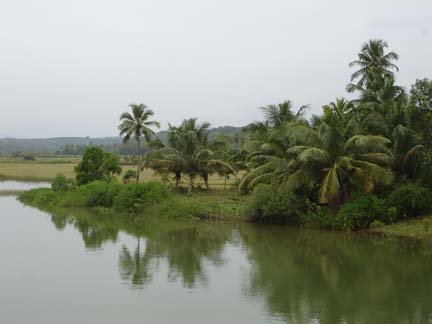
Holegadde near Honavar,Uttara Kannada dist, Karnataka
Copy? Right - but kindly remember to acknowledge!

" tulu-research.blogspot." ತುಳು ರಿಸರ್ಚ್. ಬ್ಲಾಗ್ಸ್ಪಾಟ್. ಇನ್

Have a nice day !