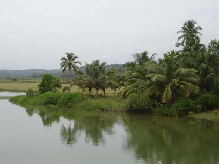
The geography of Mangalore city has changed quite a lot through the historic times. The famous two rivers Nethravathi and Phalguni (Gurupur) that gave the name Kudla to Mangalore city have changed their drainage courses several times in the past. The numerous valleys within the city are mute testimonials to the river courses that have been shifted many times like in delta areas. Italian tourist Piyatro Delavale who visited Mangalore during 1623AD reported that Mangalore is surrounded by water on three sides. Such a geographic feature was visible when the two rivers were joining the Arabian Sea between Bukkapatna and Kudroli-Alake area. Thus the Kodialbail and Attavara valleys were the locales where the rivers flew during the cited historic times.
While geological evidences like remnants of river valleys and pebble rich sediments indicate the ancient drainage courses of the two rivers, the historical place names corroborate the other half of the story.
Mangalore was under the rule of Vijayanagar Empire during 1336-1650 AD. Hakka and Bukka brothers ruled Vijayanagar at Hampi. Vijayanagar kings established a port at Mangalore for the purpose trade and exports. The port they constructed was not near the present New Mangalore Port or the old Port of British period at Bunder area. But surprisingly, it was located at the Bukkapatna area, near the present Urwa civic extension. Bukkapatna is a strange name for Tulunad. But then it was the port named after the Vijayanagar King Bukka. Even today there are many fishermen families around the area suggestive of relics of settlements around the ancient Bukkapatna port. Urwa is another old historic name. Uruwa in Tulu stands for the bamboo gate common in rural households. It also stands for the check-post. It makes sense to have an administrative check-post near the Bukkapatna port to verify materials and documents and to collect taxes in those days. Nearby Uruwa is Kottara extension. Kottara is a storehouse, stockyard or granary, again related to the Vijaynagar regality.
On the southern side of Bukkapatna is Kudroli, where the presently famous artful temple of Gokarnanatheswara has been built. The name ‘Kudroli’ has been interpreted as Kudure+Oli or horse-yard by some, implying that the location was named after the ground where horses were kept. But it seems to me that it was Kuduru+ Oli originally. ‘Kuduru’ means island within the river. ‘Oli’ means village, a word derived or influenced by Marati language. The reference name ‘island village’(<>
Tippu Sultan ruling from Sriranagpatna, constructed at Mangalore a battery for storing armaments and explosives, known as Sultan battery during ca. 1775 AD for warfare against enemies entering from the Arabian Sea. The location of Sultan battery is close to Bukkapatna, thus again proving the location of the ancient port at Bukkapatna.
Before the Vijayanagar Empire, the Alupa chieftains of Pandya dynasty were ruling Mangalore (ca 4th century to 13 century AD). It appears that their township was at Pandeswar which was on the banks of Nethravathi at that time. On the southern bank of Nethravathi was the township of Mangalapura, established after a queen from Malabar area who renounced her regality and settled in the area. Attavara (Atta+avara) is named after the ground on the other side of the river. Bolar (Bolu+Ara = barren or planar ground) was located near Mangalapura and Bolur (Bolu+Ooru=planar village) was near the port of Bukkapatna. For some time during 6th to 8th century AD, the Alupa chieftains ruled from Kulashekara area, named after the King (or chieftain) Kulashekara. At that time Kulashekara was located on the bank of a river. Apparently the rulers shifted their township from Pandeswar for some geomorphic problems like change of river course especially of River Nethravathi.
Somewhere during the end of 18th century AD, the river Phalguni (Gurupur) adapted a drastic change in its course. Until then, the river was bending near Panjimogaru and Marakada and flowing into Kottara and Kudroli areas. It took a westerly turn near Kulur flowed up to Tannirbavi and then adopted a southerly course and joined River Nethravathi. From then onwards, Rivers Gurupur and Nethravathi debouch into Arabian Sea together at a place near Ullal, south of Mangalore as can be seen today.


No comments:
Post a Comment