Showing posts with label Kudla. Show all posts

Monday, December 1, 2014

345. Mysterious History of Mangaluru

The Karnataka Government has finally resolved to officially modify the place name Mangalore to Mangaluru. However, there are voices of dissent as usual, with some preferring the ancient name Kudla. Some even may prefer the exact spelling of Mangalooru to match the appropriate pronunciation in the native languages.  
            The history of the city of Mangaluru has several shades of mystery attached to it. The place was known by different names in the past. Part of the Mangaluru city was under the Arabian Sea until probably 200 CE and the subsequent regression of the Sea,  coupled with recovery of land has been attributed to the mystic powers of Lord Parashurama in our legends. It is interesting to note that the two rivers of Mangaluru, Netravati and Phalguni have mysteriously drifted in the opposite directions across the plains of   Mangaluru though the  ages.The changes in the position of rivers with attendant seismic activities in the form of earth movements with passage of time have played major role in shaping the history and destiny of the city in the past.
           In retrospection, let us glance through the available and the reconstructed data on the history of the city.

Topography of Mangaluru at present

Megalithic and later tribes
The Mangaluru area known by different names was the home for numerous tribes in the past. Megalithic stone burial structures or dolmens, known locally as Kodakkal (=umbrella stone) existed as we find place names of Kodakkal near Padil-Kannur and (modified name of) Kodikkal near Urwa. Similarly, a number of locality names such as  Konchadi (Kom tribes), Yeyyadi, Iddya (Yey or Yedia or Idiya tribe), Maroli, Marakada, Maravur (Marava tribes), Bijai (Bija tribes), Bolar, Bolur, Belma (“Boll” or Bella: white/fair skinned tribes), Derebail, Derlakatte (Dera tribes), Eliyar padavu (Eli tribes), Kannur (Kanna tribes), Panambur (Pani tribes), Maladi, Malemar (Male tribes), Kordel (Kor or Koraga tribes), Kudumbi bittil(Kudubi tribes), Kenjar (Kench or reddish tribes), Nagori(Naga tribes), Kankanadi (Kanka tribes), Gujjarkere (Gujjars), Baikampadi, Baithurli (Bai tribes), Mangar, Mangala (Mang tribes) etc. remind us of the tribes that lived in these habitations in the past.
We can probably classify the settlers into (a) tribes of North Indian origin (b) tribes of African origin, (c) tribes of European origin and (d) tribes of austro Aisatic (Munda) origin.

Early Immigrants    of   African origin
Some of the local place names in Mangaluru are suggestive of settlements of tribals of African origin. Omanjur (Vamanjur) for example, is reminiscent of Om valley of Ethiopia which is considered to be the cradle of civilization and the deduced site of Early Man, Homo Sapien. Similarly Kinya village in the Southern part of Mangaluru Taluk is reminiscent of the region Kenya in Africa. (There is also another Kenya Village in Sullia Taluk). The Kaprigudda (or Keprigudda) near Attavar in Mangaluru reminds devotees of the ancient Egyptian Spirit God Kepri. Inccidentally, the Spirit Kepri is still worshipped in Karwar and parts of coastal Uttar Kannada.Besides, there are placenames suggestive of habitations of immigrant tribes like Derebail, Derlakatte (Dere tribes); Konchadi, Komdodi, Komapadavu (Kom tribes); Koikude (Koi tribes) etc.

Immigrants with fair skin
 Biologists have inferred that the human race initiated with black skin color and the fair or the white skin evolved in due course of time. Early tribes settled in Indian subcontinent were endowed with black colored skin. It seems along the history there was a distinct period when fair skinned tribes arrived into what was a dominion of early settled blacks. This can be surmised based on the existence of words/place names referring to fair skinned tribes/colonies of fair skinned tribes in most of the Indian languages.Thus, when tribes with fair skins arrived on the scene, they were distinguished by their distinct skin color. Bola, Bolla (or Bella in Kannada; Vella in Tamil; Gore in Hindi etc) suggest white skinned people and the settlements inhabited by these whites were termed as Bola, Bolar, Bollur, Bellur, Belman, Belgaum, Goregaon etc. Tribes with white skin were referred to Bellal (later modified to>Ballal ) or in other areas ( Vellal , Vellar). Similarly people with reddish skins (“kencha”) gave terms like Kenjar, Kemral, Kenchanakatte, Kemthur, Kemmannu, Kemminje etc.

Settlers of Austro-Asiatic Orign
Settlements of tribes of Austro-Asiatic origin, generally known as Munda tribes, are known by place names with prefix of Munda. Settlements of other tribes like Mang (Mangar, Mangala, Mangalapadi, Mangalpete), Bai (Baikampadi, Bendur [<.Bayndur], Baithurli, Bekal) etc are also known.

Settlers   of   North Indian origin
Movement of tribes within India are well documented by ethnic place names such as Gujjarkere (Gujjars), Panambur (Pani, Panab), Kannarapadi, Kannur (Kanna), Kankanadi (Kanka), Yeyyadi, Yedapadavu (Yedava, Yeyy, Idava, Yadava) etc.

Mahabharata & Ramayana
Even though several unverified obscure (now obsolete) names for a number of  places in the West Coast have been cited in the ancient Indian epics of Ramayana and Mahabharata, we are not sure what exactly was the  oldest name for  the place now we know as Mangaluru.

Olokhoira
Greek historians in the beginning of Common Era appear to have referred to the place as Olokhoira. Since the Greek travellers concentrated their attention on coastal ports of the day we can assume that Olokhoira was a marine port in those times. ( Some believe that Olokhoira may refer to ancient Udyavara).  Manjeshwara Govinda Pai has suggested that the term Greek term Olokhoira refers to Aluvakheda.
 The Aluva kheda or the Alupa kheda appears to be the present day Alupe valley (kheDa=valley, moat, depression) on the eastern part of Mangaluru city.(However, perceptions differ among the historians and a few tend to believe that Aluva kheda may refer to entire Tulunadu).

Artists impression map of submerged Mangaluru area ca 100 CE.

Legend of Parashurama
Former Alupe estuary is now a dried up river course of a deep valley between Maroli and Alupe. It was right on the West coast earlier and apparently the Greek historians referred to it as Olokhoira during the beginning years of the Common Era.  There was no mention of Mangalūru or even Kudla for the place at the beginning of Common Era! The possible reason for this is that the Arabian Sea transgressed and engulfed parts of the West Coast approximately during ca. 800 BC- 500 BC and receded only during ca. 200-300 CE. The regression of the Arabian Sea (ca. 200-300 CE) has been documented in legendary anecdotes  as a magical feat performed by a superhuman Parashurama, who was able to drive back the Sea by throwing his axe towards the Sea. The Bhargava clan ruled ancient Goa and parts of West Coast during the beginning of the Common Era and it seems that Parashurama apparently was a renowned charismatic sage among the Bhargavas. Later in the history,the  folk legends of the Parashurama appears to have been incorporated in the Sahyadri Khanda of Skanda Purana possibly during the regime of Kadamba King Mayura (ca. 400-500 CE).

Kudala- Kudla-Kodialbail
Now a days native people employ the term Kudla as an alternate local name in Tulu language for the Mangaluru city. However, it seems that originally  the term referred to a specific agricultural habitation located on the bank of a river during the pre-Dravidian days. Probably it dates back to the early agricultural phase in southern India corresponding to the period ca. 1500 BCE to 2800 BCE when horse gram ('kuDu') was one the earliest known  staple cereal grown in this region as well as other parts of the southern India.
The Kudla (Kudala) is normally pronounced with short u which probably decides the nature of the originally intended meaning of the word. The term Kudla appears to have originated as kuD+ala, wherein kuD means an agricultural or farm land and ala means a settlement by the side of river/ surface water body. The related words are Kudupu, Kudpadi, Kudthadka, etc. By analogy, the earliest pulse known to have been grown in South India happens to be known as “kuDu” (=horse gram) in Tulu language. The term "kuDu" (Macrotyloma uniflorum) appears unique to Tulu as the horse gram is known as Huruli (Kannada),Ulava (Telugu),Muthira (Malayalam), Kollu or Kaanam (Tamil), Kulith (Konkani) etc in other sister languages.[Incidentally, it has been reported that the horse gram seeds consists of polyphenols and flavonoids and proteins. Traditionally it was used in the treatment of patients suffering from jaundice and other ailments and recently it has found to contain anti-diabetic and anti-oxidant properties].
Earlier, there was an argument that the place name Kudala is actually Kūdla (or Koodla) which generally means confluence of two rivers. (The earlier proponents of this theme included this blogger also). For example, the Kannada place names Koodala, Koodali and Koodala-Sangama and so on refer to the confluence of rivers. However, Kudla (with short u) apparently has a distinct meaning different from Koodala as discussed in earlier paragraph.
           The term Kudla is at present used as a Tulu equivalent of Mangaluru. However, the exact location of the original Kudla within Mangaluru is difficult to decipher. However, it seems that  Kodial bail and the surroundings were known as Kudla to begin with.
            Regression of Arabian Sea  (ca 200-300 CE) eventually exposed and retrieved a five to six km wide tract of coastal land   buried under the sea till then. At the time of regression, the twin rivers of Mangaluru, namely the (southern) Netravati and the (northern) Phalguni (Gurupur) were flowing westward on the either sides of the (present day)  light house hill. The northern River Phalguni then flowed through the Kudala bail.
Kudala (Kud+ala) was an Ala (=habitation on the river bank) characterized of kuD (=good earth; agricultural field). The Kudala became Kudla and eventually the Kodial or the Kodial-bail, with successive settlements of new invaders with passage of time. Then the Kudla River (presently known as Phalguni) joined the Arabian Sea near Alike, south of   Kudroli temple.

Pandeshwara
The River Netravati flowed in the valley of Attavar and Pandeshwar and joined the Sea near Hoigebazar, Nireshivalaya. The estuary near Nireshivalaya served as old port known as Pandela. (The term Pandela (Pandi+ala) used to mean a boat harbor. Pandi was an old term for the sailing boat).
These evidences suggest that the Shiva temple established near the said Pandela (=Port) by Alupa rulers was designated as Pandeshwara.   The name of the God was extended as a place name that represented the area around the temple.

Mangara -Mangaruth
The area to the South of the river Netravati,the Yemmekere area, around third century onwards,  was known as Mangara. The place name Mangār has also been described in Tulu PaDdanas such as a region where the rule of the King of Mangār ("Mangarda Arasu") has been described. The ancient name Mangār within Mangaluru city still exists in the Western part of Mangaladevi area close to Yemmekere, where a premise with a group of Spirit (bhoota) shrines  continues to carry the name of Mangār compound.
The name Mangār (Mang= a tribe; ār= open field) possibly originated from the Mang tribes that inhabited the area. The Mangs are also known as Matanga in Maharastra, or as Minimadigs in Gujarat-Rajastan Region. .  It appears that whole area around Mangaladevi was earlier known as Mangār prior to the worship of Mangaladevi was introduced.
Similarly we find reference to ‘Mangarda parvata’ (Mountain of Mangar) in the Tulu paDdana (folklores) which probably refers to the present day light house hill located in the heart of the city. Thus it is possible that the light house hill was earlier known as Mangar hills.

Mangarouth
Similar to Mangarada Parvata, the ancient Port (‘Pandela’) of Mangar located near Pandeshwara (ca. 7th Century CE) appears to have been known as Mangarda or Mangarta Pandela. The pronunciation of the word was apparently corrupted in the usage of foreign travelers (Cosmas ca.650 CE) who apparently employed the word Mangarouth to refer to the Port of Mangar.
Incidentally, an area near Mangaladevi Temple is known as Manki. The “Manki stand” was a station used for parking   horse drawn jataka (Tonga) during the British period onwards. The ‘Manki’ is said to be a Munda word signifying the leader of a group of Munda tribal habitations.Thus the ancient name Manki has survived from the settlement of Munda tribes in the area.

Mayikala
The Beary people residing in the Karavali (West Coast) even now refer to the city of Mangaluru as Maikala. The word has been explained variously, some considering that the term Maikala originated from the charcoal market in the ancient town.
However it seems the word dates back to the days of prevalence of  Buddhism  in the West Coast before the rennaisance and ascent of the Hindu cult of Shakti or the Mother Goddess.  Under the spell of prevalent Buddhism, the cult of worshiping Mayi, the mother of Gautama Buddha, in specific divine plots ( kaLa or primitive form of a Temple) was introduced in several places. One of such Mayi-kala (ie Temple of Mother) dedicated to the worship of Māyi, probably existed in the ancient port town of Mangaluru. Thus it seems that the Mayi temple area was referred to as Mayikala by the Arab merchants visiting the ancient Port for trade.

Mangala
The word Mangala has several shades of meaning attached to it. Nowadays the word generally stands for the auspicious aspects of life. The term Mangala also means (1) Goddess Durga, or (2) a fort, or (3) camping ground. Incidentally, the term Durga also stands for a fort. 
However, the term Mangala (like Mangāra) initially could have evolved as Mang+ala ie, ala (=riverside habitation) of Mang tribes. It is interesting to note that Mangara and Mangala coexisted in the proximal area in the past when River Netravati flowed along the ancient path of Attavara-Pandeshwara valley, north of Mangara and Mangala.
The term Mangala also means an end or death. The ‘Mangala’  stands for culminating part (end) of a devotional chanting (bhajane) or even a traditional Yakshagana folk drama play. In the Natha tradition, the ‘Mangala’ is also said to be associated with the ceremony of death.

Mangaluru

Basically, the term Mangaluru stands for mangala+ ooru which simply means auspicious village in the current regional parlance, even though the origin of the name might have been different. The name Mangaluru has been considered to have derived from the temple of Mangaladevi in southern Mangalore. However, according to the available historical sources Shankara Acharya consecrated the pre-existing Bhagavati temple in the area as mother Goddess Mangaladevi.

Pingala shrine at Mangala 
Mangaluru, especially the Kadri, was a well known ancient center of Natha cult especially between 10th and 14th centuries CE. The Natha cult represented the transition of Buddhism to revival of Hinduism in the Southern India. According to historical sources, Queen Pingala of Kerala region was a staunch disciple of Macchendra Nath, the founder of Natha cult. She travelled to Mangaluru along with Goraksha Nath, the principal disciple of Macchendra Nath for taking part in certain celebrations associated with the Natha cult. However, unfortunately she fell ill on the way and eventually died at Mangala. According to the traditions prevalent during those days,after her death she was deified and worshiped as a Spirit or Bhagavati (in the tradition of Buddhist cult) .  Later under the waves of revival of Hinduism, sage Shankaracharya is reported to have transformed many of the former Bhagavati shrines into Temples of Shakti (the Mother Goddess) worship. Thus, the Bhagavati of Pingala was subsequently known  as Devi of Mangala  or the Mangala Devi.
These reconstructed sequence of   historical   events imply that possibly the term"Mangala" was the initial name of place.

Manjarur
One of the unusual names recorded by travelers like Rashiduddin (ca.1300 CE) and Ibn  Batuta (ca 1343 CE) for the ancient Mangaluru is Manjarur. At first it seems that the ancient usage Manjarur was a corrupt form of Mangaluru. On second thoughts, it appears that the city especially the northern part was probably known as Manjaruru under the spell of Natha cult in the city during 10th to 14th Centuries CE. However, now apparently there are no places in Mangaluru that carry relicts of the past place name Manjaruru, except Manjanakatte near Kulur and Manjalapade near Padushedde, both in the northern sector of present Mangaluru. An analysis of the Natha history evolved around Kadri temple suggests that the consecration of Manju -Natha worship was initiated at Kadri under the spell of Natha cult propogated by Macchendra Natha. Macchendra Natha, a sage of Nepal origin is said to have came to Mangaluru from West Bengal and settled in Kadri, Mangaluru. Thus it seems that during the Natha period of the history of Mangaluru, the place was   renamed as Manjaruru in honour of Manju Natha.

Manjārun
The Mangalūru was named as Manjarun in the records of   traveler Ibn Batuta (ca. 1342 CE). The term Manjarun appears to be a corrupt pronunciation of the place name Manjarur.

 Mangalūru
Obviously, the prevalent term Mangalore is an anglicized and stylized version of the place name originally  known as Mangala, Mangalapura or Mangalūru probably since 4th Century CE onwards. The name Mangalūru was popularized by Kings and administrators of   Vijaynagara who ruled over the coastal region from their capital located at Hampi in Bellary District, since 13th Century CE.

Bokkapatna: Vijayanagara Port
The Mangaluru Port during the time of Vijayanagara appears to have been located at Bokkapatna, obviously named after Bokka, one of Kings of Vijayanagara. The term Patna is a common word to represent colony or township of  Mogaveera fishermen. The name Bokkapatna has survived even till today, even though the estuary/port has migrated further south due to a natural disaster and altered its location during the year 1887.
The Port of Bokkapatna was at the ancient estuary of the River Phalguni (= River Gurpur). The Bokkapatna Port and the estuary survived up to 1887 till the river took an abrupt turn and flew  towards south and joined River Netravati, between Bengre and Ullal. It can be seen that the Battery to store war explosives (hence the name: Sultan Battery) was built near Bokkapatna by Tippu Sultan during 1769.The battery was located to counter enemies entering through the Bokkapatna, Mangaluru Port.

Mangaluru vs. Kudla
In fact the name Mangaluru comes from the southern part of present Mangalore especially the area aroud Mangaladevi. The northern part (at present central part of Mangalore) especially the area round Kodialbail was historically known as Kudla. Kudla means


Mangalur & Barkur States/Provinces
Incidentally, the Vijayanagar rulers had two coastal provinces in the Tulunadu sector, namely the (1) Mangalūru and (2) Bārkūru. In traditional ceremonies in Tulunadu until recently the gurikars (community leaders) used to welcome and call out invitees from the Mangalur seeme and Barkur seeme (seeme=territory). Even robbers were traditionally designated as Mangalur Takke   and   Barkur Takke (Takka= cheat) in   Tulu folk tales.

The Vijayanagar rulers selected Mangaluru and Barkur as these were the popular port towns in those days that specialized in exporting the goods  grown in the hinter land.

**   **

Other   Mangalūrus’, outside the Mangalūru.
The place name Mangalūru is not unique in India as there are several other  villages/towns named after Mangaluru especially in different parts of Karnataka and Maharastra. Besides, there is also an airport named "Mangalore" in Australia.
There is also a Chikkamagalur which is sometimes confused as Chikka Mangaluru. The place name Chikka-magala-ur (Chikmagalur) means younger daughters village and there is a matching Hiremagalur or the elder daughter’s   village.
Further, there are villages called “Mangalore”   in Mysore (Nanjangud Taluk), Koppal (Yelburga) and Shimoga (Sorab Taluk) Districts of Karnataka. There is a Mangalore in Cuddalore District (Tuttakudi Taluk)   of   Tamilnadu.  Besides,  Mangalore, there are two Mangaluru villages in Bijapur District (one each in Bijapur and Sindagi Taluks) and One Mangaluru in Bagalkot district (Badami taluk).
Further, there are not less than 27 places known as Mangalapur (~+a/~+am) in   Andhra Pradesh (5), Karnataka (4) Maharastra (2), Orissa (13), Tamilnadu (1), and West  Bengal (2).
**

®  

Friday, October 15, 2010

255. Import of ‘kuda’ element in place names

Lexicography and Onomastics are two closely related disciplines. Each complements the other. Linguistic connections are noticed between territories from an unknown historical past. The word ‘Kuda’, found in various languages, is an example to drive home the point. ‘Kuda’, as a suffix or prefix, is seen in place names all over India in general and in coastal belt in particular. Place names in other Asian countries too bear testimony to this observation.
Multiple meanings:
Whereas Ravi gives (in Posts-253 and 254) more stress on Ethnonym or Eponym function of popular place name ‘Kudla’ for Mangalore in Tulunadu (i.e. coastal Karnataka), I still hold the view that this Toponym bears testimony to geographical features. Multiple meanings of word elements make it difficult to decipher overall meaning of a place name, which is invariably a compound word. It is subject to many influences – geographical, cultural, political, natural catastrophes, migrations and lingual. So, modern onomastics consider that ‘a name is not simply equivalent to the sum total of its parts, but mutates at the moment of coinage’.
Kuda – what it imports?
Several meanings are found in Dictionaries of Tulu, Kannada, Malayalam, Tamil, Sri Lankan, and Maldives-Dhivehi, and in Dravidian Etymological Dictionary) for ‘kuda’, a Prakrit/Pali/Dravidian/Austro-Asian word:
Coastal Context:
Kuda/Kulhi/Kula/Ko(a)du: Used mostly describing coastal landscape, receiving sea water. It means a curve, bay, cove, gulf or sand-bank of sea or river.
‘Kuduma’ means ‘a ferry’ as per A. Manner’s Tulu-English Dictionary.
Kudaru/Kudiru/Kuduru (DED 1700) = Low ground, a hollow, bed of stream, stream. Kudura in Gond means ‘sand’. In Kurukh, it is ‘low situated rice-fields’.
‘Kuda’ in Tamil means West .(Eg. Kuda Kadal) and ‘Kuna’, East (Eg: Kuna Kadal).

Interior context:
It is also found in interior place names. In such instances, it means a hill ravine, river valley, and a nook, corner or remote and isolated place.
In Kannada, ‘Kuda’ means ‘a state of being crooked, bent, curved, a curve’. In Tulu ‘Gudke’ means crooked man. Tulu has more affinity to Kannada, especially old Kannada.
Kuda changes to Koota/Kooda when it means ‘meeting’.
In Prakrit, it means ‘a snare’ whereas in Kuwi, it is ‘cage, hen coop’.
Kuda and Kuru have the same meaning of ‘short or small’ in Tamil and Sri Lankan. Whereas in Kannada, kuru means ‘raised land or small mound or hill’.
Buddhist cave connection
Kuda means a retiring place, i.e. Buddhist Monasteries with stuptas, viharas and Buddhist cave arts. In Tulu Kude/gude (Kannada - Guhe, Sanskrit – Kuhara/Gahvara) means hole, secret place or hiding place.
Ku – a Root Word:
Reader may revisit the Post-193. It is made clear that ‘Kuda’ is a geographical term. Kuda > Kudtale refers to landed property. Place being close to water body, farming becomes important occupation of that area, besides fishing, toddy tapping and trade & commerce. So Kuda/Kudar/Kudaal/Kudla has acquired the meaning of agricultural land and people traditionally engaged in farming are called Kudva/Kuduma (Goa/Maharashtra cognate is ‘kunbi) in coastal area. Woodlanders in hilly tracks are called Kudiya > (Male) kudiyaru. Kodagu name is based on ‘Kuda > Kodu’.
Some examples
Kudla: Old name of Mangalore, still surviving in local tongue. It is coined for identifying the region, nestled in river basin/valley or at the confluence of two rivers, Netravati and Phalguni; hence has a ‘topographical signature’ of river basin. Its cognate is found in ‘Kudal’ in Sindhudurg District, Maharashtra and in ‘Kudār’, which is the old name of Malpe, a fishing town in Udupi District. The scarp, i.e. steep slope, of rocky islands, stands as true witness to ‘Kudār’. There may be a remote chance of these rocky crops having Buddhist caves before submerging. Evidences of Naga and Spirit worship are reported at these islands (See Post-182-183 – Uliyaragoli to Malpe 1&2 and Post-184 – The Magic of Malpe). It may, therefore, offer an interesting material for future research.
Kuda Caves
Kuda is a small village in Kolad at Janjira Hills Valley (Maharashtra). These rock-cut caves are classic examples of Buddhist cave art. In many of the caves in Kuda Hill, there are evidences to testify that monks used them as dwelling places. The inscriptions, letters and paintings in the Kuda Hill show that these caves are built between 1st and sixth Century BC (600-100 BCE). The Kuda caves give a magnificent view of the valley below. Hills terrain is a secluded place, hence an appropriate name ‘Kuda’ (Prakrit/Pali/Dravidian).
Kadri Hill
Kadri Hill caves in Mangalore, frequented by Buddhist monks for meditation and later on by Nath Panthi mendicants, make me to deduce Kuda>Kudla was a natural nomenclature for the area.
Hirakuda
Hirakuda Dam is the longest earthen dam across Mahanadi River near Sambalpur in Orissa, started in 1946 and completed in, 1957. It has a touch of Sir M. Visveswaraya. Before the devastating floods of 1937, he proposed a detailed investigation for storage reservoirs in the Mahanadi basin to address to the problem of floods in Mahanadi Delta. It may be interesting to note that name of Orissa is derived from original name of Odra Vishaya/Odra Desa. (Significance of Od/Odi is discussed in earlier Posts).
Kudankulam/Koodankulam
It is in Tirunelveli District, Tamil Nadu. A Nuclear Power Plant is located here.
Naachichikhudai, etc.Tamil.Net explains that these Sri Lankan place names fit into geographical description, being having a cove and curved coastline.
Moolaikkuda
This is a Sri Lankan place name for an isolated and remote place.Kuda Bandos, Kuda Hurra etc
These are atolls in Maldives. In Maldivian language Dhivehi, ‘kuda’ means marsh-land.
Kudamaloor (Kudam+al+oor)
It is located near Kottayam Town (Kerala) on the banks of Konakiri Canal. Konakiri Canal is a tributary of River Kudamaloor, which flows westward, forming a border line of Aarpookara and Kudamaloor. The land, being fertile, has many kinds of tropical trees. The greenery makes the place picturesque.
Classification
Dilation of ‘Kuda’ may be beyond the ordinary understanding and hence, may not be readily accepted. Classification of some of the place names may not be interesting but it may prove material to a serious Tulu researcher of future.
Conclusion:
I have come across a Native American proverb of unknown tribe, which goes thus: “Tell me I will forget, Show me and I may not remember. Involve me, I’ll understand.” We have been urging our readers to involve themselves by making comments but in vain. This reminds me another quote, read in ‘Jumbled Words’ game in Indian Express (28.06.2010):
“I honestly believe it is better to know nothing than to know what is not so” – Josh Billings.
As “All knowledge has its origins in our perceptions” according to Leonardo Da Vinci, isn’t the Billings’ statement a bit paradoxical? Search for meaning. It is an inspiration for a meaningful life. One can imagine the struggles of Siddhartha before attaining enlightenment and becoming a Buddha?
H.VISHWANATH, PUNE
14.10.2010

Sunday, September 26, 2010

253. Mangalore: Antiquity & Evolution-1

Mangalore has changed immensely during the last five millennia! The city of Mangalore initially evolved as a group of agricultural villages located on ancient river banks some 5000 years ago! The position (flow-paths) of the ancient rivers of Mangalore, have changed with passage of time, but the original agricultural signature villages have remained as fossil place names!
India was populated by early humans migrating since ca.120,000 years according to recent studies. Early pre-history of Mangalore is hazy but it was definitely home for numerous ancient tribal immigrants from Africa, northern India and Austro-Asiatics from Southeast Asia as found and immortalised in the numerous ethnonyms preserved to this date.

Kudla
The familiar Tulu name for Mangalore is ‘Kudla’. Often the name ‘Kudla’ has been confused with ‘Koodla’ (=confluence of rivers). However, the confluence of two rivers that bound the Mangalore city at present, namely Phalguni (Gurupur) and Netravathi, happened only in the year 1887. (Cf: Post 98 in this blog). Before that period the two rivers were flowing independently and not showing any features of confluence! Therfore, the ‘koodla’ or confluence definition for kudla ventured in older posts herein (No16, 17) or other inspired texts requires amendments.
The word ‘Kudla’ (kuD+la) should be understood as agricultural village on river bank. Let us look into this explanation in detail.

Ancient Agricultural phase :(ca.3000 BC-400 BC)
Tulu rural people have a special fascination for the humble horse-gram (‘kuDu’), do you know why? ‘KuDu’ (Tulu) or ‘Huruli’ (Kannada), or the horse gram was the earliest agricultural food crop preferentially grown by our ancestors some 4 to 5 millenia ago as found out by archeo-botanical studies in southern India!
Within Mangalore there are atleast four areas that were formerly (ancient, ca. 3000-1500BC) dedicated to the cultivation of earliest known crop, the horse gram (‘kudu’). Of these, the place names ‘Kudla’ and ‘Kudupu’ are well known.

Ancient Rivers of Mangalore: Phalguni
Geological studies (conducted by our team during the last two decades) evince interesting historical and paleo-geographic data on the rivers of Mangalore. The flow paths (channels) of the two rivers of Mangalore, namely Phalguni (Gurupur) and Netravathi, have continuously changed paths several times during the period of last 10,000 years or more.
One of the interesting aspects of geological and historical data correlation is that the River Phalguni was flowing along what is presently known as Kodialbail (recognisible as a paleo-valley paths), cutting across Mahatma Gandhi Road near TA Pai convention center and flowing across Alake and joined the Sea near Kuduroli. As far as geological evidences for the existence of river channel are concerned, you can see distinct presence of water worn quartz pebbles preserved in the soil zones all along the paleo- river path described above.
The ancient village names actually support the geological findings. The name Kudla suggests agricultural/farm area (kuD) beside a river (‘ala’). Similarly ’Alake’ (Ala+ke) is a village on river bank, ‘ke’ being a spatial suffix of south-east Asian Austro-asiatic origin. Thus we can correlate the time of flow of Phalguni along Kodialbail to the ancient agricultural Kudla phase estimated at ca.3000-2000 BC, based on archeo-botanical studies in southern India.
Further, Kuduroli represents a village (Oli= village) of ‘kuduru’s (=riverine islands). The ‘Kuduroli’ place name may be slightly later in time and coined after the period the river shifted its position northwards from Alake- Kuduroli area.

Kudu, horse gram
Kud (u) =meant agricultural land ( ‘kuDu’, pre-Dravidian word of Munda origin: ku+du, ku=good,prosperous; du=land).Kudu (=horse gram) represented one of the earliest grown and consumed cereal grain in southern India. According to paleo-botanical evidences, Rice, the major food crop of the south, was introduced in southern India probably during ca.800-400 BC period. (Kudugol, Kannada word, is an agricultural/farming, crop cutting sickle.).
Incidentally the equivalent Kannada word ‘huruli’ is a modification of ‘uruli’, where uru=land and uru+li means product of earth. Thus both the words ‘kudu as well as ‘uruli’ reflect the deep respect early farmers had toward the earth.
Kudla= A habitation formed during ‘kudu’ phase. (Kud+la, Kud=agricultural land, la= a habitation beside a flowing stream,river).The word ‘Kudla’ has been also interpreted as kooD+la or confluence of rivers, but the agricultural explanation appears more appropriate because in the original area identified as ‘Kudla’ (or Kodialbail) proper, there is no evidence of any sort of confluence of rivers!
Kudupu= An agricultural (Kudu) village.
Kudthadka (near Bajal) = A field (aDka) dedicated to farming. kuDuta +aDka
Kudpadi (Jeppu)= A shady zone (shrub or tree grown area=’pāDi’) dedicated to Kudu farming.
Almost all these places were originally on the banks of river, now with passage of time most of the rivers have changed their flow paths due to earth movements. KuDupa (=farmer) was one of the ancient proper names among Tulu people.
It can be seen that ‘koDipu’ (=to sprout) evolved from the original word ‘kuDu’. With this, ‘koDi’ and ‘koDa’ place names like Kodipadi, Kodavur etc evolved.

Pre-Dravidian signatures
Kudu place names are not exclusive to Tulunadu. Infact Tulu people have inherited this word from the pre-Dravidian culture of Munda civilization had dominated in southern India, before the advent of Dravidian speakers. Even though there were skirmishes between the Munda aborigines and Dravidian immigrants as testified in 'Devi Mahatme' and other epics of the period, Dravidian culture gradually absorbed essence of of the older Munda language and culture as testified by the presence of older Munda words as well as continuation of Munda place names in Tulunadu and other pats of southern India. As a proof you of pervasive Munda civilization in southern India, you can find kudu place names in other parts of Karnataka and Maharastra such as Kudle, Kudne, Kuditi, Kuditini etc. Besides, ‘Kudubi’ or ‘Kudumbi’ were an ancient agricultural tribes.

Associated Naga cult
One of the possibilities apparent in the analysis of Kudu village names is the growth and association of Naga worship cults along with the Munda agricultural phase. Prehistoric agricultural development in Tulunadu lead to destruction of natural forest areas and the wild serpents began to invade cultivated farm areas. The farming tribes were appalled at the sight of snakes that had magical powers to terminate people by their venomous stings. The early farmer had no other choice but to pray ardently to these serpents for the security of his family and livestock.
The Kudupu village was an ancient centre of Naga worship.(Later it was transformed to centre of Kumara/Skanda worship). The derived word ‘koDapu’ means to sting (like a serpent bite). And the word ‘koDa’ also represented a ‘Naga’ or serpent. A special word in this connection is ‘koDamaNi’ (as found in the name of the Tulu Spirit Kodamanittaya) which possibly represents the ‘Nagamani’ or the mythical gemstone found on the hood of cobra.
®

Sunday, June 27, 2010

246. Kudla : A controversy

-->
The word ‘Kudla’ is an ancient name and refers to the city of Mangalore.What is the meaning of this word Kudla? If you answer me that ‘Kudla’ means ‘kooDla’ or a confluence of two rivers, you may not be precisely reflecting the original meaning of this word!
Let us analyse this controversy.
A Confluence  of Rivers?
 Fluvial Geography of Mangalore city at present

Yes! Most of us, including this blogger, were under the impression that ‘kuDla’ means a confluence region of two rivers, Gurpur and Nethravati. You can also find this explanation in some of the earlier posts filed in this blog or write-ups published in periodicals.This opinion is also shared by the mighty Tulu Nighantu.
The Tulu Nighantu lists three meanings for the word Kudla (p.823):
1. Mangalore town, a confluence of two rivers.
2. Again. [The Tulu usage ‘kuDala kuDala’ means to repeat again and again.]
3. (a) a confluence of two rivers, (b) a   confluence of a stream and a river. [Latter, also known as ’KooTel’]
Thus the  cited entries 1 and 3 above suggest emphatically that kuDla means a confluence.
The assertion that KuDla= confluence is based on the word koodla as in place names ‘KooDala Sangama’ (of Basaveshwara fame, Bagalkot district) or ‘KooDali’ (a confluence of Tunga and Bhadra rivers, Bhadravati Taluk).
Paleo-geography of Mangalore:
In Mangalore we have a confluence of Gurupur and Nethravati rivers between Bengare and southwestern corner of Mangalore city.However,the confluence of Gurpur with Nethravati River occurred relatively recently ie in the year 1887.That is to say that confluence as seen now did not exist in the historical past! Thus ancient word ‘kudla’ may not be referring to any recent confluence!
Secondly, the word ‘Kudla’ even though applied at present to Mangalore as a whole in general, was originally referring to apart of present Mangalore, especially the Kodialbail area.Kudla was the Kudla bail to begin with which with passage of time changed into Kodial-bail or simply Kodial. This Kudla bail or Kodial bail is a valley region once upon a time occupied by Phalguni River which changed its course (probably around 7th Century CE or earlier) further northwards in the course of time.
Thus the truth is that KuDla is not kooDla!
It was an fertile river plain in the antiquity that was amenable for good agricultural crops!
Let us explore the alternative explanation.
Agricultural settlement
Dr Gururaj Bhat (1963) in his work ‘Tulunadu’ passingly remarked that Kudla is not ‘kooDla’ or a confluence (p.29, 2009 edition). He pointed out that Kuduva tribes iniated agricultural practices in ancient Tulunadu.Kuduva tribes in different areas and times were also known as Kudi, Kudu, Kudubi, Kudumbi, Koda, Kunubi etc. The Munda word kuDa reffered to ‘good agricultural lands’ and those tribes associated with agriculture were known as KuDi or KuDubi.
Ku+ Da + ala. = An agricultural settlement on the river plains.
Ku=good, Da=land, earth. KuDa=good land, agricultural land. Ala= river plain or habitation on the river plain.
There are many villages in the Karavali having the prefix of KuDu.
KuDupu .(A village in eastern Mangalore on Nanthur -Vamanjur NH13 road).
KuDuma.  (Old name for Dharmastala, Belthangadi taluk).
KuDumbi hittil ( A residential area near Falnir, Mangalore).
KuDipäDi .( A village near Vamadapadavu, Bantval taluk)
Kudne, Maharastra
Kudle  beach, Gokarna, Uttar Kannada.
Note that in above place names suffixes –pu, Ne,-le etc are indicative of settlement or habitation areas.
According to Dr Padur Gururaja Bhat (ibid) ‘kuDu’ later transformed into ‘koDu’ as seen in place names KoDiala,KoDimbadi, KoDavur,KoDlaDi,KoDangala, KoDange etc.
KuDu
KuDu also represents horse gram which incidentally is the first agricultural food crop grown in southern India. Agriculture in southern Indian River plains was in vogue ca. 2000-2500 BC according to archeo-botanical studies. This takes the age of the place name Kudla to that period, ca 2000-2500BC. The word KuDäla is derived from ancient and pre-Dravidian Munda languages of southern India.
®

Wednesday, April 18, 2007

17. Historic Mangalore: Port of Bukkapatna

The geography of Mangalore city has changed quite a lot through the historic times. The famous two rivers Nethravathi and Phalguni (Gurupur) that gave the name Kudla to Mangalore city have changed their drainage courses several times in the past. The numerous valleys within the city are mute testimonials to the river courses that have been shifted many times like in delta areas. Italian tourist Piyatro Delavale who visited Mangalore during 1623AD reported that Mangalore is surrounded by water on three sides. Such a geographic feature was visible when the two rivers were joining the Arabian Sea between Bukkapatna and Kudroli-Alake area. Thus the Kodialbail and Attavara valleys were the locales where the rivers flew during the cited historic times.

While geological evidences like remnants of river valleys and pebble rich sediments indicate the ancient drainage courses of the two rivers, the historical place names corroborate the other half of the story.

Mangalore was under the rule of Vijayanagar Empire during 1336-1650 AD. Hakka and Bukka brothers ruled Vijayanagar at Hampi. Vijayanagar kings established a port at Mangalore for the purpose trade and exports. The port they constructed was not near the present New Mangalore Port or the old Port of British period at Bunder area. But surprisingly, it was located at the Bukkapatna area, near the present Urwa civic extension. Bukkapatna is a strange name for Tulunad. But then it was the port named after the Vijayanagar King Bukka. Even today there are many fishermen families around the area suggestive of relics of settlements around the ancient Bukkapatna port. Urwa is another old historic name. Uruwa in Tulu stands for the bamboo gate common in rural households. It also stands for the check-post. It makes sense to have an administrative check-post near the Bukkapatna port to verify materials and documents and to collect taxes in those days. Nearby Uruwa is Kottara extension. Kottara is a storehouse, stockyard or granary, again related to the Vijaynagar regality.

On the southern side of Bukkapatna is Kudroli, where the presently famous artful temple of Gokarnanatheswara has been built. The name ‘Kudroli’ has been interpreted as Kudure+Oli or horse-yard by some, implying that the location was named after the ground where horses were kept. But it seems to me that it was Kuduru+ Oli originally. ‘Kuduru’ means island within the river. ‘Oli’ means village, a word derived or influenced by Marati language. The reference name ‘island village’(<>

Tippu Sultan ruling from Sriranagpatna, constructed at Mangalore a battery for storing armaments and explosives, known as Sultan battery during ca. 1775 AD for warfare against enemies entering from the Arabian Sea. The location of Sultan battery is close to Bukkapatna, thus again proving the location of the ancient port at Bukkapatna.

Before the Vijayanagar Empire, the Alupa chieftains of Pandya dynasty were ruling Mangalore (ca 4th century to 13 century AD). It appears that their township was at Pandeswar which was on the banks of Nethravathi at that time. On the southern bank of Nethravathi was the township of Mangalapura, established after a queen from Malabar area who renounced her regality and settled in the area. Attavara (Atta+avara) is named after the ground on the other side of the river. Bolar (Bolu+Ara = barren or planar ground) was located near Mangalapura and Bolur (Bolu+Ooru=planar village) was near the port of Bukkapatna. For some time during 6th to 8th century AD, the Alupa chieftains ruled from Kulashekara area, named after the King (or chieftain) Kulashekara. At that time Kulashekara was located on the bank of a river. Apparently the rulers shifted their township from Pandeswar for some geomorphic problems like change of river course especially of River Nethravathi.

Somewhere during the end of 18th century AD, the river Phalguni (Gurupur) adapted a drastic change in its course. Until then, the river was bending near Panjimogaru and Marakada and flowing into Kottara and Kudroli areas. It took a westerly turn near Kulur flowed up to Tannirbavi and then adopted a southerly course and joined River Nethravathi. From then onwards, Rivers Gurupur and Nethravathi debouch into Arabian Sea together at a place near Ullal, south of Mangalore as can be seen today.

Sunday, April 8, 2007

16.Mangalore: Kudla and Nitria


Mangalore, the sultry and vibrant coastal town of Karnataka, has a long history. It also has several alternate names. Tulu people call it Kudla; Konkani’s prefer it as Kodiala; Malayalam people call it Mangalapuram; Beary people prefer the term Maikala. The Arabian traders preferred the term Maikala for Mangalore, possibly around 6th century AD. Possibly it was an Arab word. But there is little written history.

In Greek literature of early Christian era, there is said to be reference to an Oloikhera, which has been interpreted as Greek version of the name Aluva Kheda.

We do not find mention of either Mangalur or Kudla in Greek reports. Instead we find the port of Nitria mentioned. Nitria was probably the port located on the estuary of River Netravathy. Nitria must have been derived from an Indian word, possibly something like Netra or Netria. Geological inferences reveal that the near the confluence between the Rivers Netravathy and Gurpur there was an eye shaped island. This eye shaped half-island (small peninsula), Netra (=eye) or Netriya, must have prompted the Greek historians to refer to as Netria. In that case, name of the River Netravathy also must have been derived from the shape of the island. Netra or Netriya If this deduction is correct then the earliest known name of Mangalore appears to be Netra or Netriya.

Mangalore is the anglicized version of the name MangaLooru. Premilla, a queen of Malabar, renounced her kingdom and became a disciple of Matsyendranath of Nath cult. She traveled with her Guru towards Kudla (or Mangalore) but had to settle near Bolar as she fell ill on the way. Eventually she died there and local people built a temple in reverence to her. The temple was renovated subsequently by an Alupa ruler, Kundavarma during the year 968 AD. Thus the town was known as Mangalapura.

The term Mangala also means fort, so a few believe because an ancient fort the name came. Infact,the name Mangalapura is found in the inscriptions earlier to the period of installation of Mangaladevi temple, ie., 968 AD. The Mangaladevi temple in the southern part of the city, reminds us that the city was named after goddess Mangaladevi. Thus Mangalapura later became Mangalooru during the Vijayanagar period. They called it Mangalur Rajya.

The name Kudla is a native geographic term indicating confluence of two rivers. The words KooD or KooDi (joined)+ala(=rivers) have become (1) kooDala > Kudla , and (2) kooDiala > koDiala. In other words, Koodla or Kudla is the Tulu equivalent of the Sanskrit word, sangam.The word Koodala is also there in Kannada. The river confluence of Kudalasangama is quite famous since the time of Basaveswara, the social reformer.Similarly the township at the confluence of Tunga and Bhadra rivers in Shimaoga district is known as Kudli.

A number of significant geographic modifications have taken place in Mangalore area during the historical past. At present, River Nethravathy flows westerly and joins the Arabian Sea, south of Mangalore town and north of Ullal area. And the other River Phalguni (Gurpur) flows westerly up to Tannirbavi, near New Mangalore Port. Near Tannirbavi, very close to the beach, hardly 500 meters from the beach-sea interface, River Phalguni takes an abrupt southerly turn and flows southward till it joins the River Nethravathy north of Ullal.

This geographic situation was much different during the historical past. The rivers Phalguni and Nethravathy were flowing within the present city area of Mangalore and joining the sea near the Alake-Bokkapatna area.


Blog Archive

Books for Reference

  • A Comparative Study of Tulu Dialects By Dr. Padmanabha Kekunnaya. Govinda Pai Reserach Centre, UDupi. 1994
  • Koti Chennaya: Janapadiya Adhyayana. By Dr. Vamana Nandavar. Hemanshu Prakashana ,Mangalore.2001.
  • Male kudiyaru. Dr B. A.Viveka Rai and D.Yadupathi Gowda, Mangalore University,1996.
  • Mogaveera Samskriti By Venkataraja Punimchattaya. Karnataka Sahitya Academy.1993.
  • Mugeraru:Jananga Janapada Adhyayana. By Dr Abhaya Kumar Kaukradi.Kannada & Culture Directorate,Bangalore & Karnataka Tulu Academy, Mangalore,1997.
  • Puttubalakeya Pad-danagalu. Ed: Dr B.A.Viveka Rai,Yadupati Gowda and Rajashri, Sri Dharmasthala Manjunatheswara Tulu Peeta. Mangalore University.2004
  • Se'erige. Ed:Dr K.Chinnapa Gowda.Madipu Prakashana,Mangalagangotri,2000.
  • Studies in Tuluva History and Culture.by Dr P Gururaja Bhat (1975).Milagres College,Kallinapur,Udupi.
  • Taulava Sanskriti by Dr.B.A.Viveka Rai, Sahyadri Prakashana,Mysore 1977
  • TuLu naaDu-nuDi By Dr.PalthaDi Ramakrishna Achar, Puttur.
  • TuLu NighanTu. (Editor in Chief: Dr U.P.Upadhyaya, Govinda Pai Research Centre,Udupi. Six volumes. 1988 to 1997
  • Tulu Patero-A Philology & Grammar of Tulu Language by Budhananda Shivalli.2004.Mandira Prakashana Mangalore. p.317. (The book is in Tulu Language using Kannada script)
  • TuLunadina ShasanagaLa Sanskritika Adhyayana. By Shaila T. Verma (2002) Jnanodaya Prakashana,Bangalore, p.304.(Kannada)
  • Tuluvala Baliyendre. Compiled by N.A.Sheenappa Hegde,Polali,Sri Devi Prakashana,Parkala,1929/1999

A Coastal estuary

A Coastal estuary
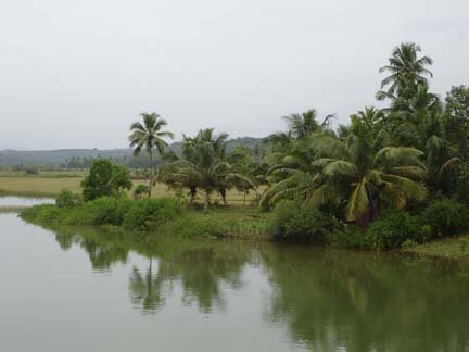
Holegadde near Honavar,Uttara Kannada dist, Karnataka

Copy? Right - but kindly remember to acknowledge!

Creative Commons License
This work is licensed under a Creative Commons Attribution 3.0 License.

" tulu-research.blogspot." ತುಳು ರಿಸರ್ಚ್. ಬ್ಲಾಗ್‌ಸ್ಪಾಟ್‌. ಇನ್

" tulu-research.blogspot."  ತುಳು  ರಿಸರ್ಚ್.  ಬ್ಲಾಗ್‌ಸ್ಪಾಟ್‌. ಇನ್
Have a nice day !